The Location of San Pedro Norte? A Spot For A School
Ambergris Caye is a large island – over 25 miles in total length – where the population for the most part, resides in a very small area. (Estimates range from 15 to 30 thousand depending on who you talk to) San Pedro town (you can see the location in the Google map below) is the center of all things that make a township a town. The schools, the polyclinic, the police and fire departments and the government buildings.
You can see the town of San Pedro at the bottom quarter of the island – and move all the way north to the Belize/Mexico border.
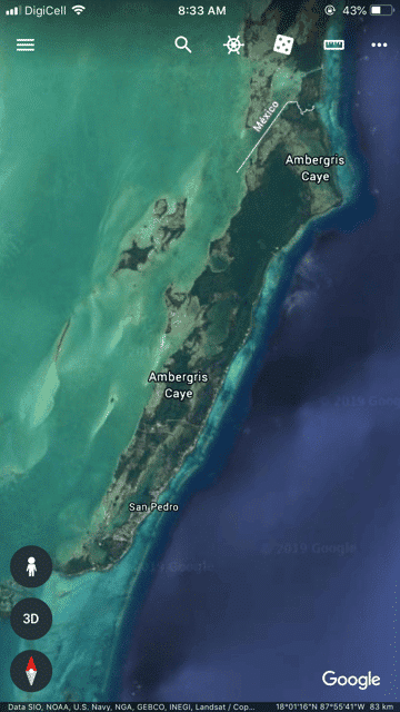
For years there has been speculation, as development and some (but not all) utilities reach farther and farther north of the need for another town – another “urban center” – farther north.
Over the past 5 or so years, land has been distributed to Belizean citizens around the areas of 8 – 10 miles north. 100s of lots were granted in the relatively vast and unpopulated mangrove forests on the west side of the road in that area.
Note: I was always under the assumption that as a Belizean citizen, you were guaranteed a small parcel of land in a country with very low population density for Central America. But as I’m researching more…I finding that it is not in the constitution. But perhaps an unwritten law? I’ve found this wording from AmbergrisCaye.com: There is a “homesteading” program that is basically a way for Belizeans to lease land or a lot for a nomimal amount, and, after they’ve cleared it and built on the property, can buy it inexpensively. It is open to officials residents who are non-citizens, but I believe it requires three years of residency before you become eligible.
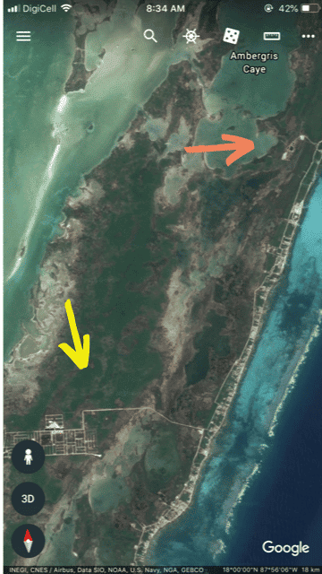
A privately owned quarry has also been developed in this same area – to mine limestone fill and to truck it all over the island. The quarry – at about 8 miles north – is marked with a orange arrow. For reference, the road to Secret Beach (at about 4.5 miles north) is marked with a yellow arrow.
Note: Google Earth image is from 2016. The quarry is HUGE now….a vast moonscape that runs to the edge of Cayo Frances Lagoon – the body of water under the orange arrow.
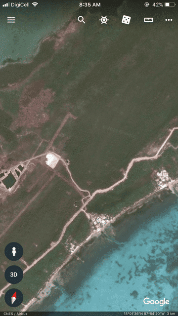
In the past few months, we have been hearing excavators running day and night in the quarry and yesterday, we drove north to check out what’s going on. I’d also heard rumor of another road cutting into the mangroves and heading west. Here’s what we found…
This is the area – dense dense DENSE mangrove – bordered on the east by the road (about miles 8-9) and to the west by the Cayo Frances Lagoon.
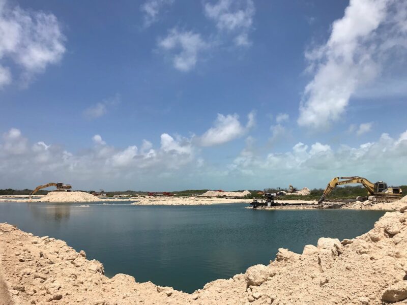
Here is a picture at the entrance to the quarry…
And then back out to the main road, we drove…maybe 1/3 of a mile north. Passing this roller – they are smoothing the road between the quarry and this new road.
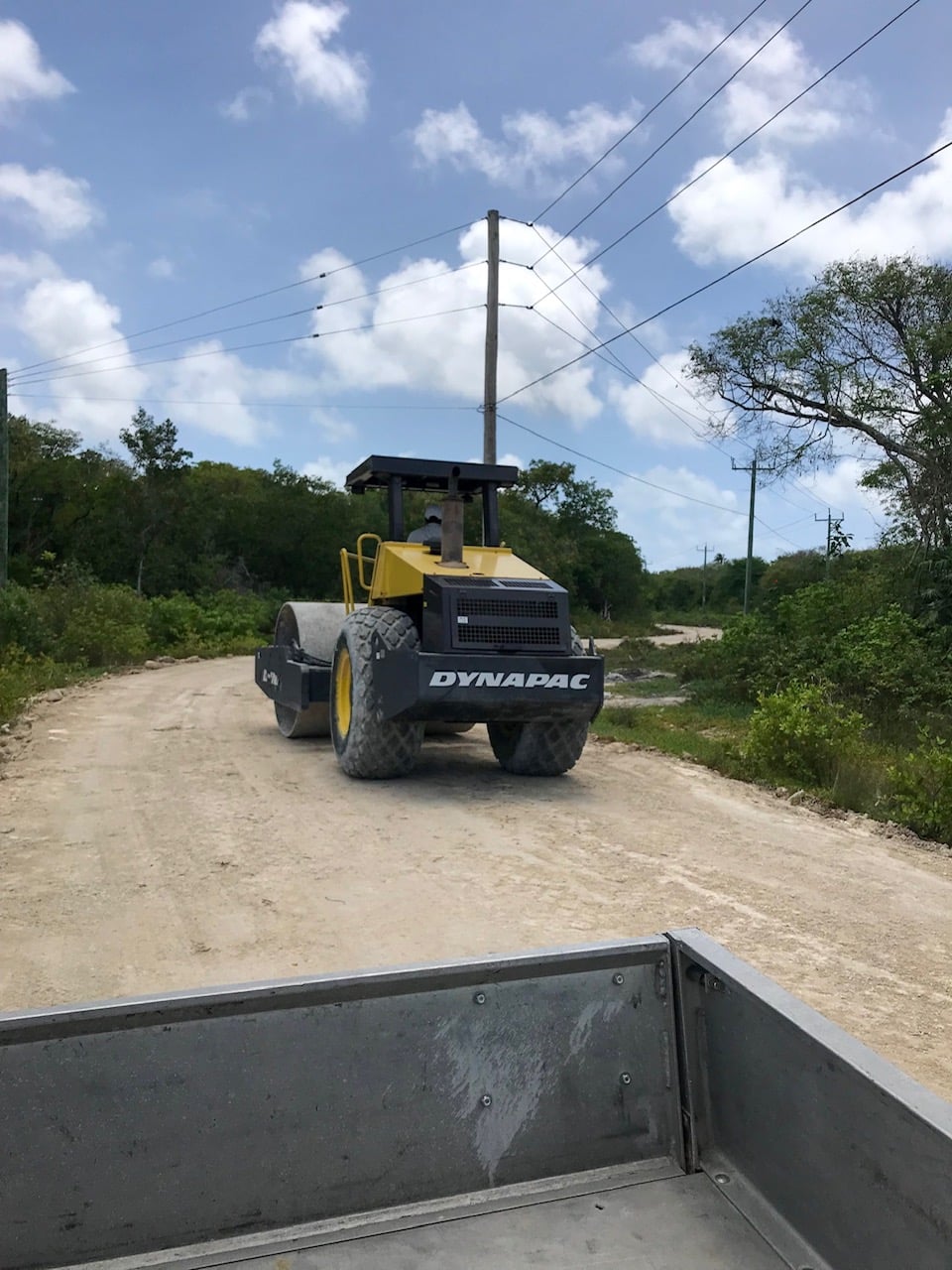
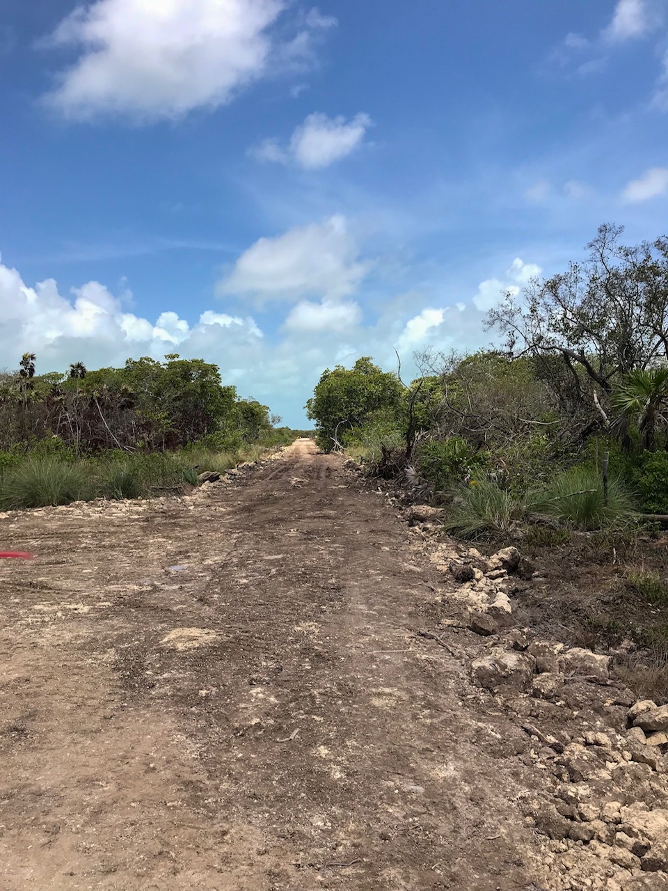
So the truck can more easily transport fill. Here is the cut into the mangroves and the new road.
We bumped a few hundred feet back into the bush and came upon a LARGE clearing. 10-15 acres I would estimate.
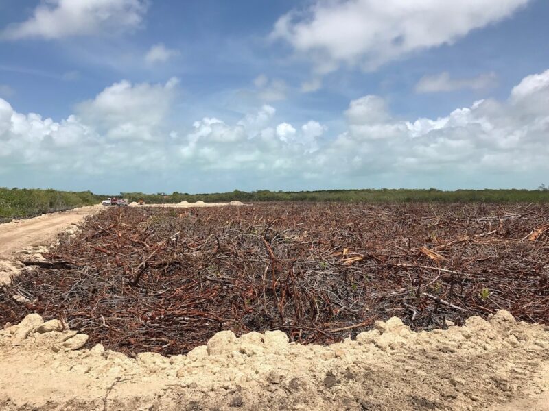
Trucks were beginning to fill. What is this?
I asked and was told that it is a clearing for the new government High School and Primary School.
THE NEW TOWN?! Could this be the beginning? I don’t know. There are lots of questions.
Is there a time frame for construction or are we not at that phase yet?
Does this mean the road will be fixed all the way up north?
How would all the school kids get up here?
I have none of the answers. Just reporting back on what I saw…
I will call our new town on the north end of the island, San Pedro Norte. Let me know if you have a great name for it.
Posted in: