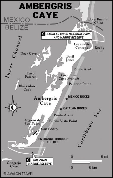
Adventure to Ambergris Caye’s Cantena Lagoon (Laguna De Cantena)
In the far north of Ambergris Caye, just south of the winding canal cut between Mexico and Belize is the island’s largest lagoon. Laguna de Cantena. Named not for the Spanish word meaning fldiner or eatery (cantina) but from Maya “Kantenah”. “Kan” means snake.
It is at least an hour and a quarter’s boat ride from town due north (we went on the west leeward/side of the island). As you move up the island, you see fewer and fewer buildings (most are at Secret Beach) and very few boats.
Once we got above about 10 miles north – around the area of Cayo Frances Farm and Fly – we barely saw a soul. There are two fishing shacks along miles and miles of beach and mangrove…and there were two flyfishing boats working the shoreline trying to stay out of the wind.
This map has wording over the lagoon but you can see where Belize is separated from Mexico (they say the Maya dug this canal) – and the Laguna de Cantena. You also get a sense of the barrier reef (that grey blob) up there – where it hits the land – and then continues northward. Much of the area is a National Park and Marine Reserve – and it is basically untouched since the Maya were there.
(The Belize Travel site says that it is popular for hiking. That seems crazy, this is crazy…this area, this lagoon and thick thick mangroves…dense littoral forest, mosquitos a plenty, and even pumas and jaguars is no spot for hiking)
About once a year – Jeff and I drive north to the Basil Jones area in the golf cart (on the opposite side of the island – the reef side). He heads up there more often for some DIY flyfishing. You can see our last golf cart adventure here – a beautiful day in January 2022.
But this time we were taking a boat ride into the Cantena Lagoon. Because there is nothing that excites flyfishermen more than the idea of checking out new waters or “habitats”.
I tagged along because well…it’s cool! To check out a part of the island I’ve never seen before and to go thru the Bacalar Chico canal.
Hilian, friend and great guide, picked us up on Back-a-Back Street in San Pedro. Very close to where San Pedro is marked on the map below. And off we went. (You can read this great story about Hilian and the battle for a tarpon off Ambergris Caye)
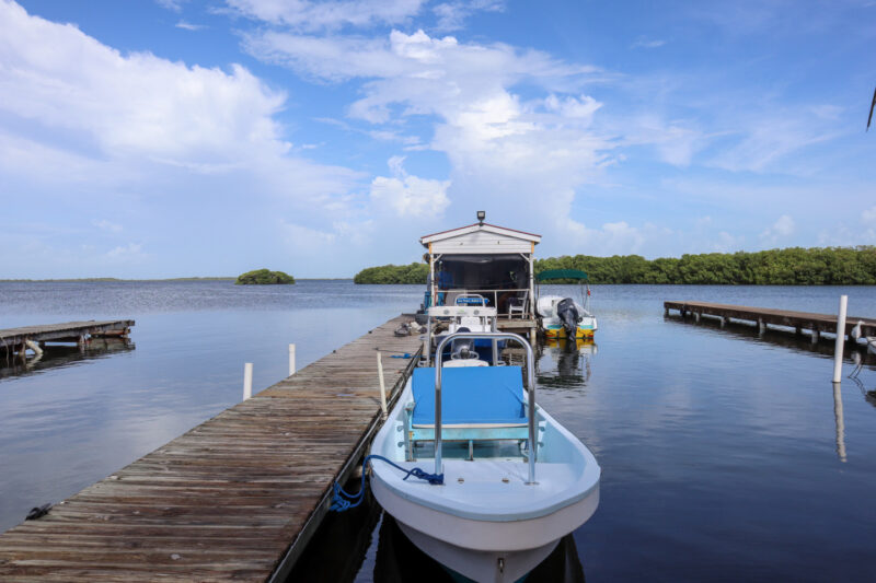
Out of the San Pedro lagoon and north…passing Cayo Frances and the long caye called Bracilete…Deer Caye, the Santa Cruz Lagoon and then the rangers station at the north end of the island.
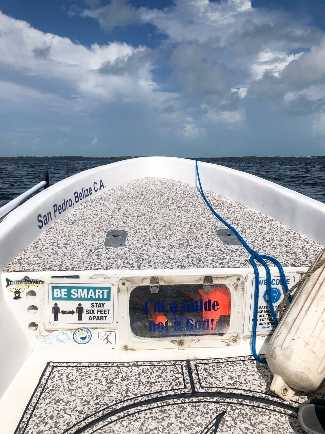
Love the “I am a Guide, Not a God” sign.
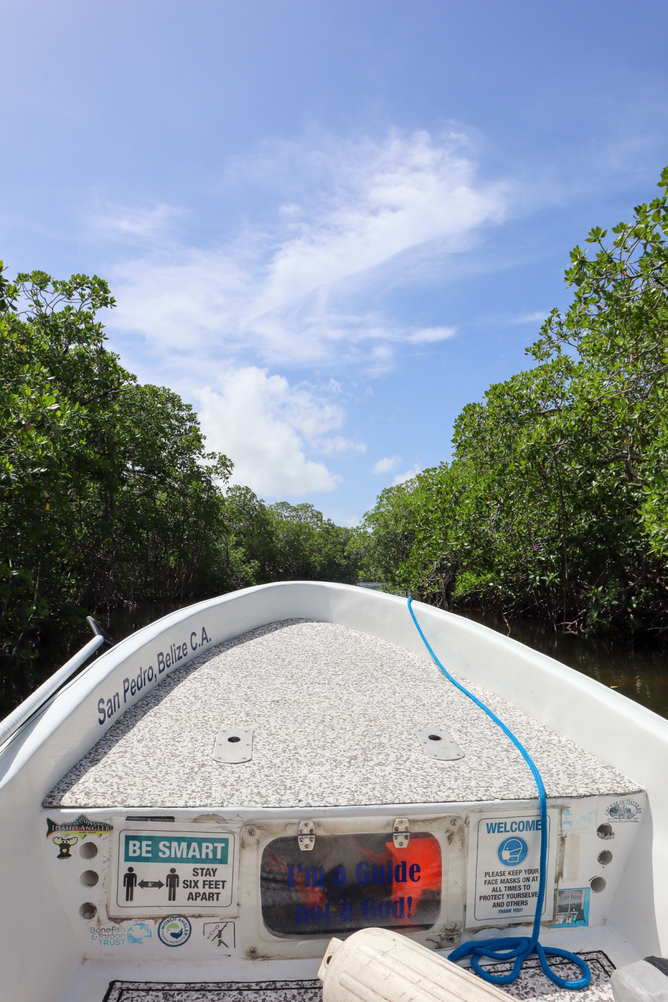
We headed into the canal separating Mexico and Belize. Who says there are no jungles on Ambergris Caye?
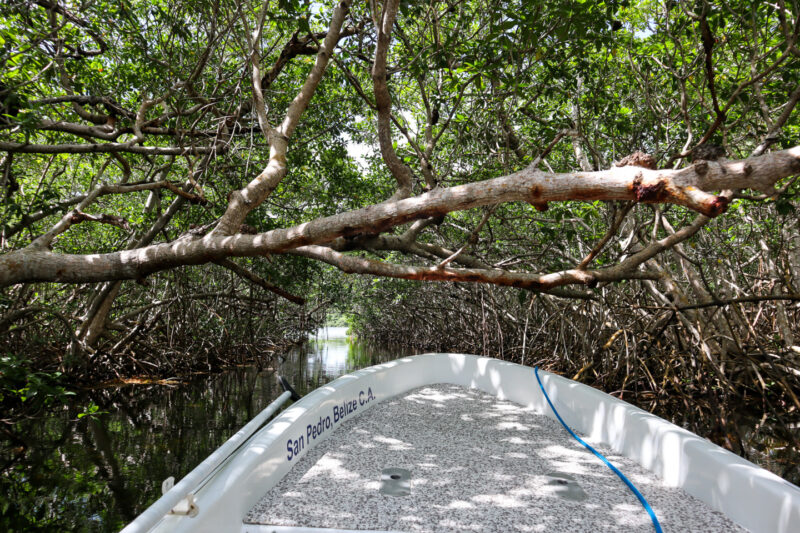
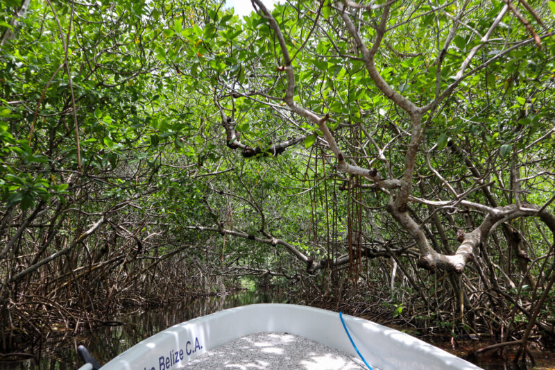
The red mangroves are so dense…they are beautiful. It’s hard to see where actual land starts…maybe not for 15 feet…maybe not for a few miles? In between the roots, the water is dark maroon and rust colors where the tannin seeps from the mangrove roots. This is a formidable landscape.
And yet…we see two Maya sites up there. Because, as Hilian would later tell us, this area – the shallow lagoons – was a salt production factory for the Maya. HOW AMAZING IS THAT?
If you didn’t know where you were going, you would very quickly become lost up here. I mean lost for days trying to find the entrance/exit to this lagoon. And it’s very easy to lose your orientation very quickly – the “rule” that the coastline runs north to south is no rule up by Rocky Point.
It’s a low thick entrance to the lagoon. The trees vibrate with birds and cicadas and I hope that’s it.
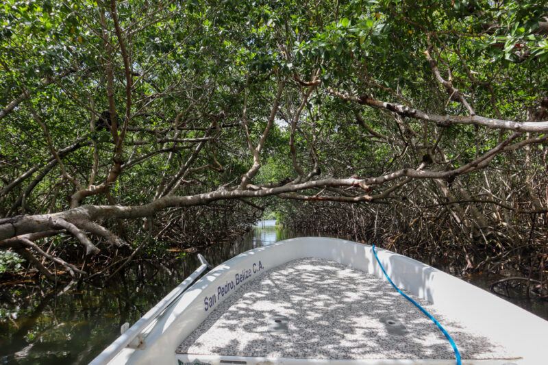
There is one low-hanging mangrove and I ask Hilian why no one has removed this…impediment. It is worn smooth underneath where it has been scraped by poling platforms and probably heads.
“It’s illegal to cut mangroves in Belize,” he says. It reminds me what amazing stewards the fly fisherman are of this island.
This cut is natural. Mangroves grow up to the water that flows in and out of the lagoon.
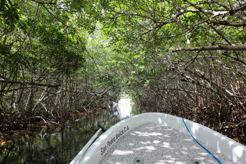
Once we are in the lagoon, it is hardly full throttle ahead. It is a few feet deep in some areas…inches in others. There is a sand bar that we need to move particularly slowly around. One that has a rock right in the middle. Good things Hilian knows exactly what he is doing. He also seems to know every crevice and offshoot of the lagoon…even island (and there are lots) and hole.
“Sometimes you can find snook there when the tide is right”. “The bottom is rock right here” “There are tarpon in that deep channel by that one island”. It’s really incredible.
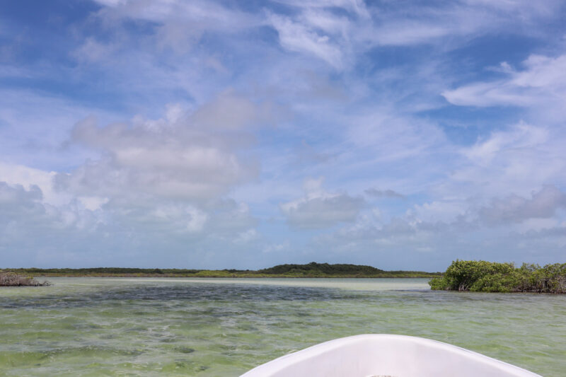
The lagoon is also huge – you can barely see the other side.
Below you can see the sandbar and the rise of one of the Maya sites. How amazing is it to picture dozens of people controlling the flow of this super saline water to make salt? Hundreds of years ago?
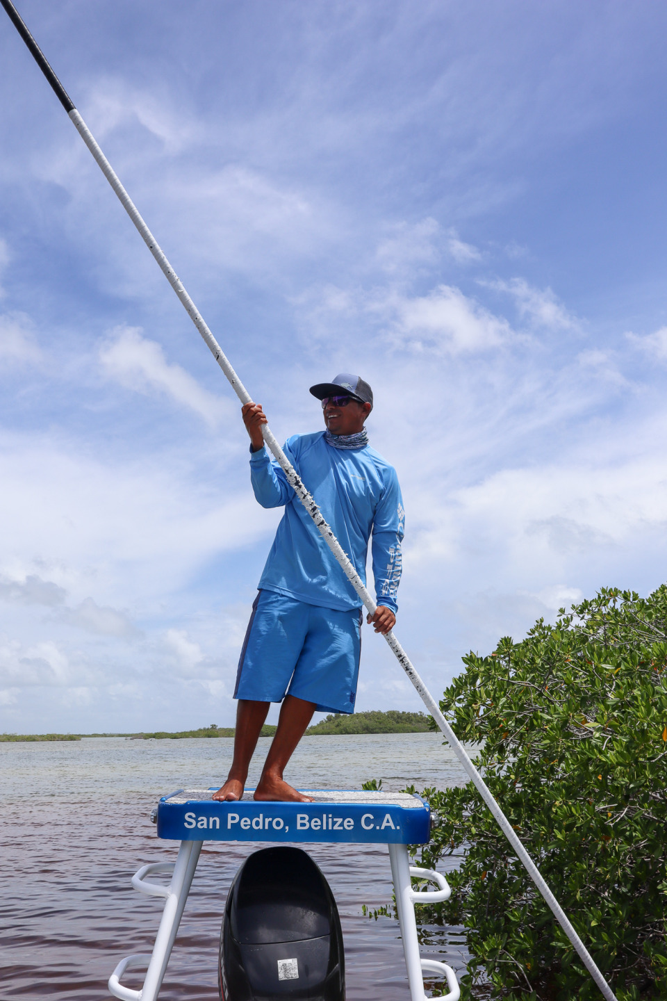
Hilian poling us into an area of interest.
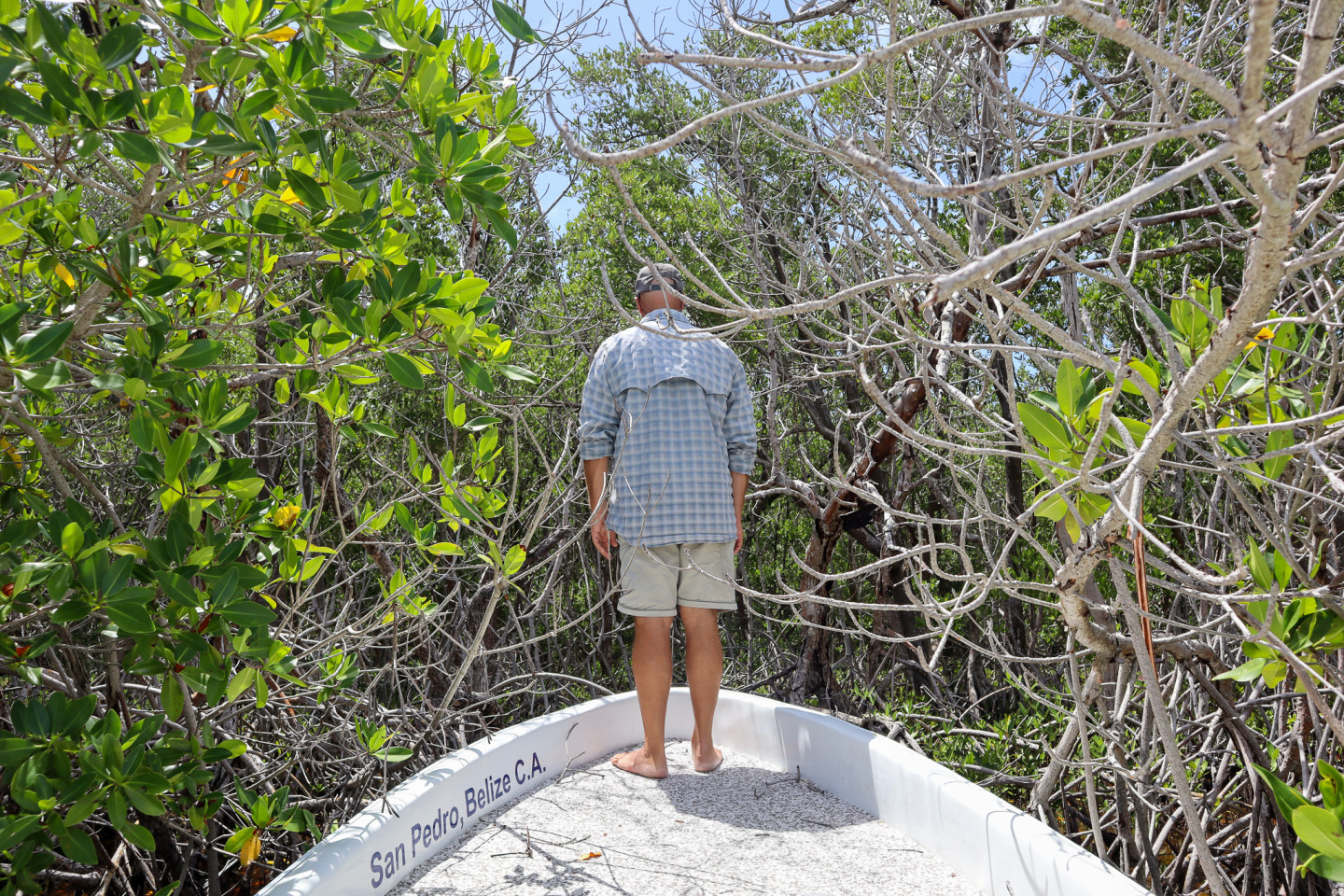
And Jeff checking something out…
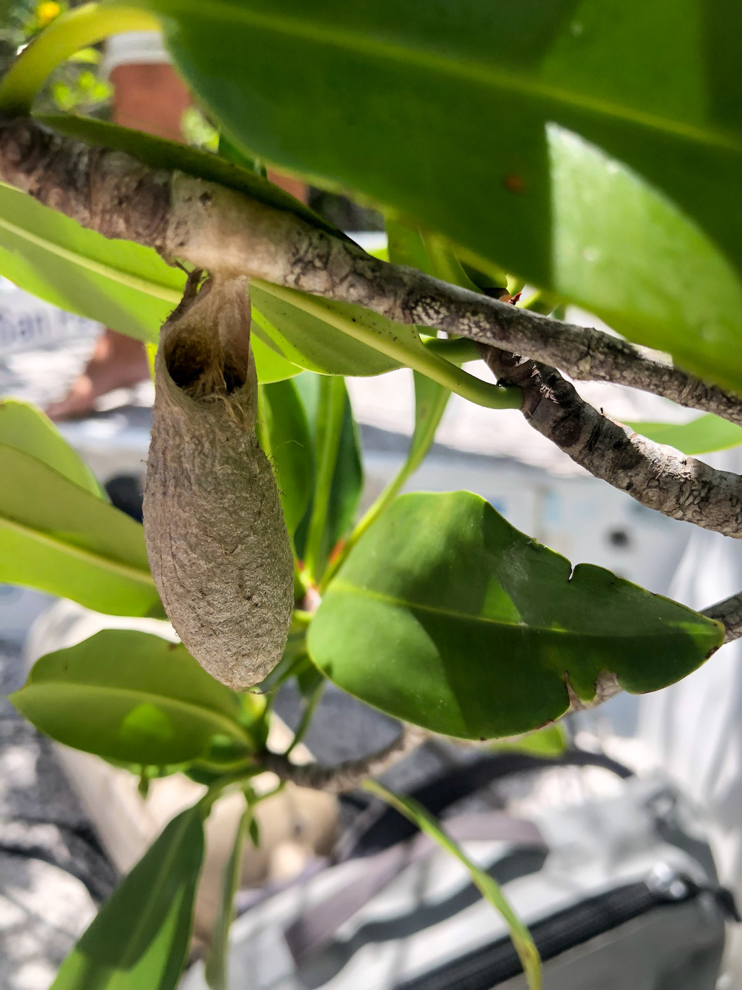
Me swatting mosquitos and trying not to disturb whatever was in this nest/cocoon larger than my thumb.
We explored a bit more and then headed back down the coast. We saw a Mexican boat and a family fishing by the canal but that’s about it.
This island is amazing. We made the trip in about 4 hours…saying again and again to ourselves and each other “It’s incredible how big Ambergris Caye is…”
2 things before I close. 1. I applied 50 SPF sunblock as we were leaving and still got SCORCHED. It’s like I just moved here but more than that, it is the fact that, the sun here is NO JOKE. There is good reason that flyfishermen are covered from head to toe when they go out to fish…buffs, hats with silly flaps, long pants, booties…it’s a matter of survival. And 2. When we got home, both of our IPhones had set themselves to Belize time + 1 hour. It took us the rest of the afternoon to figure out it was because we had been in Mexico…or at least close enough…
Posted in: